Measured Building Survey Services UK

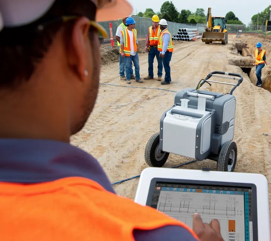
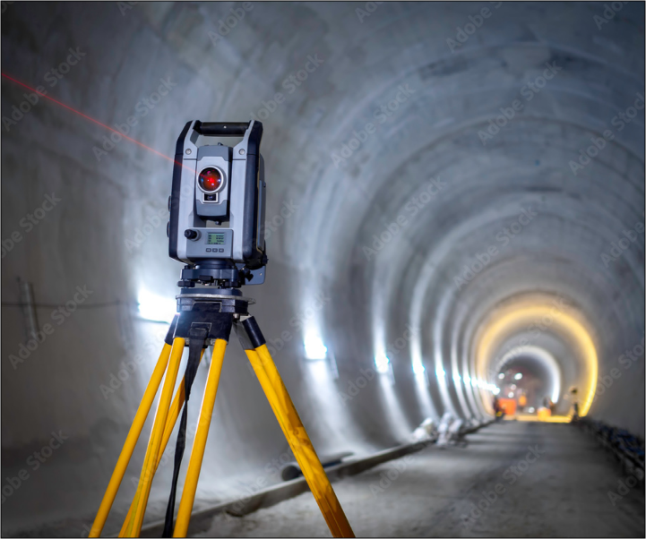
Accurate measurements are the foundation of every successful construction, refurbishment, or design project. A single error in a building’s dimensions can result in costly delays, compliance issues, or structural problems. 

With a Measured Building Survey, you gain precise, reliable data that informs every stage of your project and ensures work proceeds safely, efficiently, and without unexpected setbacks.

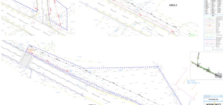
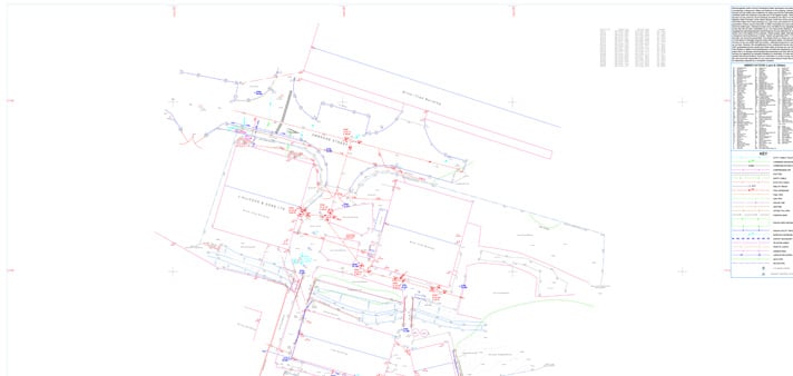
At Intersect, we deliver detailed surveys for professionals across the UK, including architects, civil engineers, contractors, and project managers. Beyond capturing measurements, we provide actionable insights that reduce risk, improve planning, and help projects run smoothly from start to finish. 

Whether you are refurbishing a historic building, managing a complex infrastructure project, or planning a commercial development, our surveys provide the clarity needed to make informed decisions.

Why You Need a CCTV Drainage Survey

A Measured Building Survey is the process of accurately recording a building’s dimensions, structural features, and spatial relationships. 

Unlike basic floor plans, these surveys generate detailed professional drawings that represent the true condition of a property. They are vital for renovations, extensions, or any design project that relies on accurate structural data.

Measured surveys involve capturing:

  • Internal and external dimensions, including walls, doors, windows, and openings.
  • Structural elements such as beams, columns, and load-bearing walls.
  • Fixtures and fittings, including mechanical, electrical, and plumbing components.
  • Levels and elevations, documenting floors, ceilings, and roof heights.

Accurate surveys prevent costly mistakes, ensure compliance with building regulations, and support efficient project planning. Professionals across construction and design sectors rely on measured surveys to reduce uncertainty and make informed decisions at every stage of a project.

Understanding Measured Building Surveys

Key Benefits of a Measured Building Survey

Investing in a Measured Building Survey offers multiple advantages:

Reduce Project Risks

Early detection of structural anomalies, hidden beams, or irregular dimensions prevents costly on-site errors and ensures construction proceeds smoothly.

Ensure Compliance

Surveys provide the detailed documentation required by building regulations and planning authorities, helping projects pass inspections with minimal delays.

Support Project Planning

Accurate measurements allow architects, engineers, and contractors to plan effectively, reducing rework and enabling efficient use of materials.

Avoid Costly Mistakes

Reliable survey data minimizes errors in design, material procurement, and construction, saving time, money, and effort throughout the project lifecycle.

Roadway and Pavement Radar Surveys

Who Uses Measured Building Surveys

Measured Building Surveys are essential for a range of professionals in the construction, engineering, and design sectors:

Architects

Architects rely on precise building layouts to develop renovations, extensions, and new designs. Accurate plans help create functional, aesthetically pleasing spaces that align with the existing structure.

Civil Engineers

Engineers use measured surveys to assess load-bearing structures and evaluate potential modifications. This data helps ensure structural integrity and informs engineering decisions.

Project Managers

Project managers rely on accurate measurements to coordinate schedules, manage resources, and anticipate potential challenges during construction.

Contractors

Contractors use survey data to avoid on-site errors, reduce material wastage, and streamline construction processes. Accurate measurements help teams maintain project timelines and budgets.

Measured surveys are invaluable for projects ranging from small renovations to large-scale developments, providing professionals with the confidence to proceed without uncertainty.

Roadway and Pavement Radar Surveys

Our Approach to Measured Building Surveys

At Intersect Surveys Ltd., we combine traditional surveying expertise with modern technology to deliver accurate and actionable survey data.

Step 1 – Site Assessment

Our team evaluates the property’s size, complexity, and specific requirements to determine the best surveying approach. Understanding the building and its intended use ensures the survey captures all necessary information.

Step 2 – Data Collection

We use laser scanning, total stations, and drones to capture precise measurements. Each tool is selected based on the property’s characteristics, ensuring comprehensive and accurate results.

Step 3 – Data Processing

Raw data is converted into CAD drawings, 3D models, and detailed plans. Our processing ensures measurements are usable for design, planning, and construction teams.

Step 4 – Quality Assurance

Every survey undergoes rigorous checks to verify accuracy. We ensure that all dimensions and features are correctly recorded, providing survey data that professionals can trust.

Step 5 – Delivery

We provide detailed reports, floor plans, elevations, and BIM-compatible files tailored to your requirements. Deliverables are clear, actionable, and ready for immediate use in your project workflow.

Vector 3

Technology We Use

Accuracy in measured surveys depends not just on expertise, but also on using the right tools for each project.

Laser Scanning (LiDAR)

LiDAR captures millions of data points to generate highly accurate 3D models of interior and exterior spaces. It is particularly useful for complex or historic buildings with intricate details.

Total Stations

Total stations provide precise angular and distance measurements, allowing for detailed and accurate mapping of structural elements and building layouts.

Drones

Drones survey roofs, facades, and other difficult-to-access areas quickly and safely. This technology reduces risk and ensures comprehensive data collection without disrupting site operations.

CAD Software

Advanced CAD software converts collected data into professional floor plans, elevations, sections, and 3D models that integrate seamlessly with design and engineering workflows.

Vector 3

Measured Building Survey Deliverables

Our surveys are tailored to meet your specific project requirements, with deliverables that include:

Floor Plans

Scaled, detailed plans of all building levels showing walls, doors, windows, and fixed installations.

Elevations and Sections

Vertical measurements and cross-sectional views that provide a complete understanding of the building structure.

3D Models and Point Clouds

Digital models that integrate into BIM systems, enabling precise design and analysis.

As-Built Drawings

Accurate representations of existing building conditions after construction, renovation, or modification.

Reports

Comprehensive documentation highlighting structural observations, anomalies, or areas requiring attention, ensuring informed project decisions.

Vector 3

Applications of Measured Building Surveys

Measured surveys are versatile and support multiple sectors and project types.

Refurbishment Projects

Ensure renovations align with the actual building structure, reducing rework and unexpected costs.

Historic Building Conservation

Document original features for preservation and restoration, maintaining architectural integrity.

New Construction Integration

Incorporate new builds with existing structures seamlessly, avoiding design conflicts and construction delays.

Property Transactions

Provide accurate layouts and floor plans to support property valuation, sales, or leasing processes.

Planning Permissions

Supply planning authorities with detailed documentation to facilitate approvals for construction or refurbishment projects.

Vector 3

Challenges in Measured Building Surveys

Complex properties can present unique challenges that require specialized expertise.

Irregular Structures

Historic or non-standard buildings often have unique layouts that need careful measurement techniques.

Limited Access Areas

Attics, basements, roof voids, and other confined spaces require thoughtful planning and specialized tools.

Obstructed Interiors

Furniture, machinery, or ongoing construction can obstruct access, which our team overcomes with experience and careful methodology.

Solutions

By combining skilled surveyors with advanced tools such as LiDAR, total stations, and drones, we capture every detail accurately, regardless of site complexity.

Vector 3

Why Choose Intersect Surveys Ltd.

Choosing the right survey provider is critical to project success. Professionals across the UK trust Intersect Surveys Ltd. because of our expertise, reliability, and attention to detail.

Expertise Across Sectors

Our team has extensive experience working with architects, engineers, and contractors on complex projects across multiple sectors.

Attention to Detail

Every survey is carefully checked to guarantee accuracy, providing professionals with data they can rely on.

Advanced Technology

Our use of modern survey tools ensures comprehensive data collection and precise deliverables suitable for all project types.

Clear Communication

We provide actionable insights alongside survey data, ensuring findings are easily understood and applied.

Nationwide Coverage

We operate across the UK, offering measured building surveys for projects of any scale.

Vector 3

Preparing for a Measured Building Survey

Maximizing survey efficiency begins with preparation.

Ensure Clear Access

Make sure all rooms, corridors, and critical areas are accessible to the survey team.

Mark Obstructions

Identify temporary hazards, equipment, or restricted areas that may affect data collection.

Provide Existing Drawings

Previous plans or documentation assist in validating new measurements and identifying discrepancies.

Specify Deliverables

Clarify the level of detail, formats, and specific requirements to ensure the survey meets your project needs.

Vector 3

Integrating Measured Surveys with Other Services

Measured surveys often complement additional services offered by Intersect Surveys Ltd.

Topographical Surveys

Topographical data provides context about the surrounding site, helping integrate building and landscape planning.

Underground Utility Detection

Detects drainage, plumbing, and utility networks to prevent project delays and ensure safety during construction.

Structural Monitoring

Monitor structural movement over time to support renovation projects and ensure ongoing stability.

Environmental Assessments

Incorporate environmental and sustainability considerations into project planning and compliance.

Vector 3

Cost and Value of Measured Building Surveys

Understanding the cost of a Measured Building Survey is essential for planning your project budget effectively. 

While prices vary depending on property size, complexity, and specific requirements, the true value lies in the accuracy and reliability of the data you receive. Investing in a high-quality survey helps prevent unexpected issues, saving both time and money in the long run.

Factors Affecting Cost

Survey cost varies based on building size, complexity, accessibility, and level of detail required.

Value for Money

Accurate surveys prevent costly errors, save time, and support informed decision-making throughout your project.

Transparent Reporting

We provide clear reports outlining survey coverage and deliverables, ensuring clients understand the value and scope of services.

Vector 3

Ensuring Long-Term Accuracy

Maintaining long-term accuracy is essential for the success of any construction or refurbishment project. 

Even minor changes in a building’s structure over time can have significant implications for design, maintenance, and future development. Regularly updating survey data ensures that decisions are always based on reliable, current information.

Re-Surveys for Updated Projects

For phased projects, refurbishments, or building expansions, periodic re-surveys confirm that all measurements remain accurate and reflect any structural changes.

Integration with Future Designs

Accurate survey data can be reused for future design modifications, ongoing maintenance planning, and long-term facility management, providing a dependable reference for years to come.

Vector 3

Environmental Considerations

In today’s construction and surveying landscape, minimizing environmental impact is an important consideration for any project. 

Sustainable practices not only protect the surrounding environment but also help projects run smoothly with less disruption. By integrating advanced, low-impact technologies, we ensure surveys are both accurate and environmentally responsible.

Sustainable Survey Practices

Using drones allows us to capture precise measurements without the need for extensive on-site activity. This reduces the carbon footprint of surveying and limits disturbance to the site and surrounding areas.

Minimal On-Site Impact

Our methods enable detailed data collection efficiently, avoiding disruption to ongoing operations while maintaining high accuracy and safety standards.

Vector 3

Safety and Compliance

Safety and compliance are fundamental to every Measured Building Survey. Protecting both personnel and property is our top priority, and we implement strict protocols to ensure every survey is conducted safely and efficiently.

Site Health and Safety

Our survey teams adhere to rigorous health and safety standards, using appropriate protective equipment and safe working practices. Whether working in confined spaces, at height, or around operational sites, we minimize risk to both staff and the surrounding environment.

Regulatory Compliance

All surveys fully comply with UK building standards and planning regulations. This guarantees that deliverables are legally robust, reliable, and suitable for planning submissions, project approvals, and ongoing construction activities.

Vector 3

Technology-Driven Accuracy

In today’s construction and design projects, precision is non-negotiable. Leveraging modern surveying technology allows us to capture data with exceptional accuracy, ensuring every decision is based on reliable measurements. 

Our approach combines multiple advanced tools to create a complete, precise picture of a property’s layout and structural details.

Combining LiDAR, Drones, and CAD

By integrating LiDAR scanning, drone surveys, and CAD software, we can collect comprehensive 3D data efficiently. This ensures that measurements are not only precise but also fully compatible with digital workflows used by architects, engineers, and project managers.

Preventing Costly Errors

Early detection of structural anomalies or spatial conflicts minimizes the risk of costly corrective work during construction, saving time and resources while supporting confident project planning.

Vector 3

Booking a Measured Building Survey

Scheduling a Measured Building Survey with Intersect Surveys Ltd. is simple and designed to fit around your project needs. Early planning ensures your survey is carried out efficiently, providing accurate data to support design, construction, or refurbishment work.

Quick Consultation

Reach out to our team to discuss your property, project scope, and the type of deliverables you require. This initial consultation helps us understand your needs and tailor the survey accordingly.

Site Assessment Scheduling

We arrange survey visits at times convenient for you, ensuring minimal disruption while collecting precise measurements.

Delivery of Results

Once the survey is complete, we provide detailed reports, CAD drawings, and 3D models promptly in your preferred format, ready for immediate use in your project workflow.

Vector 3

Partnering with Intersect Surveys Ltd.

A Measured Building Survey from Intersect Surveys Ltd. provides professionals across the UK with the confidence to plan, design, and build accurately. 

Combining industry expertise with advanced technology, we help clients mitigate risks, save time, and make informed decisions every step of the way.

Frequently Asked Questions (FAQ)

How long does a survey take?

+ -

Survey duration depends on property size, complexity, and level of detail required. Small properties may take a few hours, while larger or complex sites can require multiple days.

Can you survey occupied buildings?

+ -

Yes. Our team works around occupancy to minimize disruption while maintaining accurate data collection.

How does it differ from standard floor plans?

+ -

Measured surveys provide comprehensive structural, fixture, and elevation data, unlike basic floor plans that often omit critical information.

Are your surveys BIM-compatible?

+ -

Absolutely. We provide 3D models and point clouds that integrate seamlessly into BIM workflows for architecture and engineering teams.

A reliable and efficient company

”We've been working with Intersect for several years and have always found them to be reliable, efficient and good value for money. I can honestly recommend them."

testimonial-image

Peter F , Commercial Director

Excellent customer care

”The whole process was very smooth from start to finish, with excellent communication and customer care. We'll definitely be working with Intersect in the future."

testimonial-image

Henry P , Director

Efficient and knowledgeable

”The in-depth knowledge which Intersect Surveys have in their field is second to none. They're efficient, helpful and in my opinion, excellent value. "

testimonial-image

Robert M , Site Manager

What Our
Clients Say

Who We
Work With

News & Blogs

Monitoring in Real-Time: How Live Alerts Reduce Structural and Environmental Risk

Alex Shiels 18 Aug, 2025

On a busy construction site, things can change in an instant. A small shift in a retaining wall, a spike in dust...

Structural vs. Environmental Monitoring: What's the Difference and When Do You Need Both?

Alex Shiels 15 Jul, 2025

Why Environmental Monitoring Can’t Be Ignored As urban development grows more complex, project teams face rising...

Why Environmental Monitoring Is No Longer Optional for Construction Sites

Alex Shiels 14 Jul, 2025

Why Environmental Monitoring Can’t Be Ignored Construction sites today operate in a climate of increased...

Get in touch

Choose Intersect Surveys as your preferred provider. Simply fill out the form and an expert will be in touch to handle your enquiry. We always aim to get back to you within 24 hours.


Indicate the Area for Surveying

Show us the area you would like us to survey, by firstly adding the postcode to search, then click on the black circle icon and circle your area on the map.