Ensure your project gets off to the right start by commissioning a land survey. For quick, accurate and data-rich information, look no further.
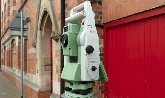
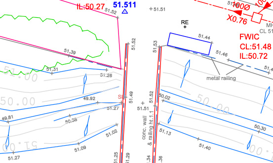
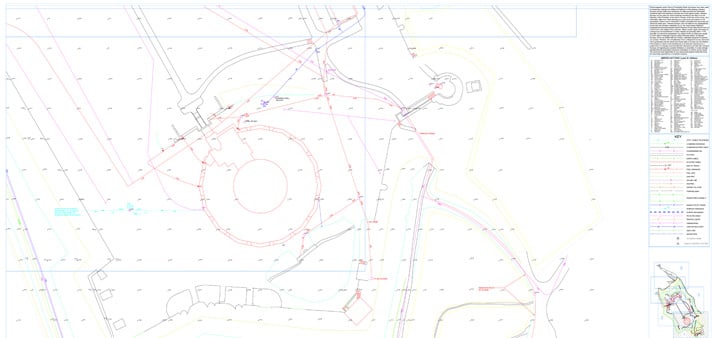
Topographical Survey
Robust survey practice combined with the latest technology allows Intersect Surveys to deliver highly accurate Topographical Surveys for small & large-scale engineering projects, architectural design phases, & planning developments.
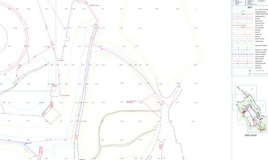
Topographical Surveys produced include all natural and man-made features.
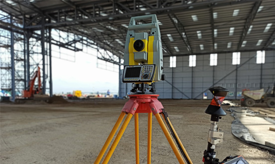
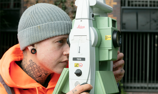
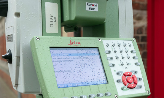
How is this data captured? We use integrated Leica Robotic Total Stations, GNSS and 3D laser scanning to efficiently capture survey data in two or three dimensions, with the output available in a range of industry formats to meet any requirement.
These maps aid in the Planning & Design process for Architectural & Engineering purposes, and we can provide any level of detail, accurately Surveyed, edited, & presented to suit your needs.
All our Survey Data can be delivered in a variety of industry standard 2D & 3D digital formats.
Talk to us today and we will provide you with an efficient & cost-effective solution to all your Topographical Survey requirements.
Measured Building Surveys
We produce Measured Building Surveys to accurately represent building layouts, from single-storey houses, multi-storey office buildings, to listed heritage buildings.
Using an extensive range of 3D laser scanning technology, robotic total stations & hand-held tablets to efficiently capture highly accurate data, Intersect Surveys can provide a solution to all your Measured Survey requirements.
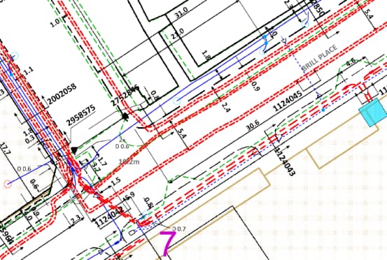
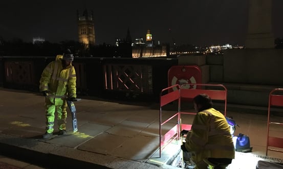
Electromagnetic Detection
We Can Provide:-
· Floor Plans
· Elevations
· Cross Sections
All our Survey Data can be delivered in a variety of industry standard 2D & 3D digital formats.
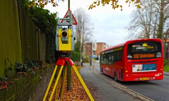
Site Control & Setting Out
Providing comprehensive Engineering & Setting Out Services designed to meet your specific engineering & construction requirements.
GNSS, total station & precise levelling techniques are combined to establish & maintain all site control.
We also provide our site based staff with engineering technical support & guidance, to ensure all works are carried out correctly according to current ‘best practice’ methods.
Site Control & Grid Systems
Establish primary survey control for small & large-scale projects.
Verify existing primary survey control.
Establish gridline's, datum's & FFL's on site.
Contruction verification as-built surveys.
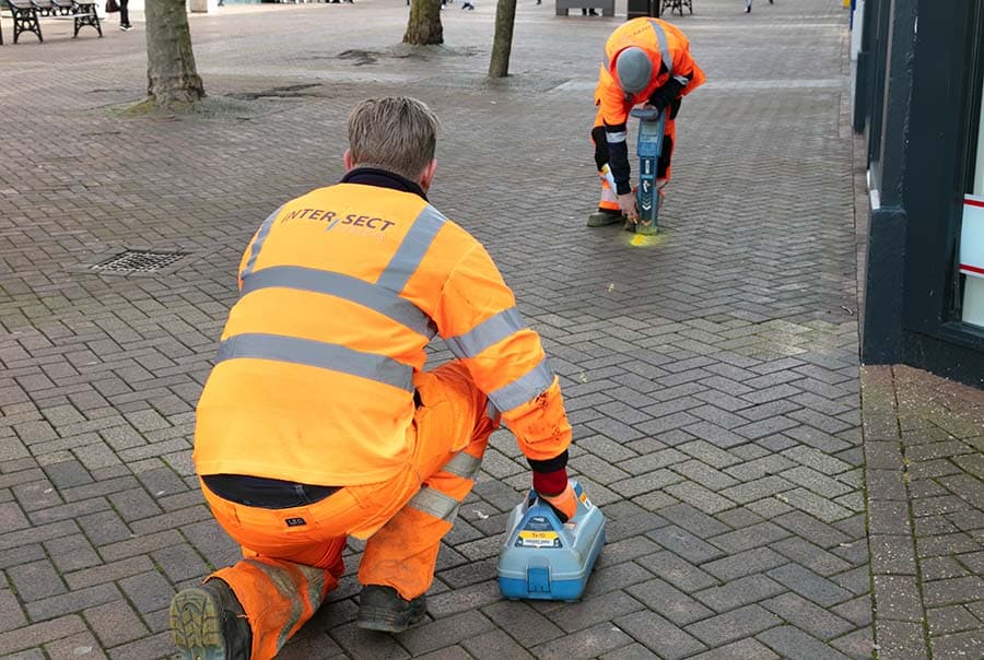
Setting Out Engineering
Setting Out is the process of transferring the coordinates of a building, road or structure from design drawings to the ground/site. Markers can be set out on the ground using stakes, nails or bolts depending on your requirements and/or ground conditions.
We provide a highly skilled team of experienced engineering surveyors capable of delivering a wide range of small & large-scale construction & engineering projects.
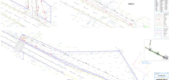
Multi-Disciplinary surveys, guaranteeing assurance across the project lifecycle
Whether you require land, underground utility or engineering services, Intersect Surveys is here for you.
Select from a range of services including, Underground Utility Detection & Mapping, CCTV Surveys, 3D Laser Scanning, Topographical Surveys, Measured Building Surveys, Setting Out, Structural & Environmental Monitoring Solutions.
No matter your sector, our multi-disciplinary survey offering has been designed to cater to your unique requirements.
Construction Verification As-Built
As-Built Surveys provide critical information to the design process and allows project managers & design teams to track positional accuracy and design tolerances across a wide range of projects.
Accurate survey data can provide project managers & design teams with vital information in relation to the true positional accuracy of constructed elements when compared against the intended design.
Using an extensive range of high-definition 3D laser scanning technology, robotic total stations & hand-held tablets to efficiently capture highly accurate data, Intersect Surveys can provide a solution to all your construction verification survey requirements.
We provide our survey data in a variety of industry standard 2D & 3D digital formats.
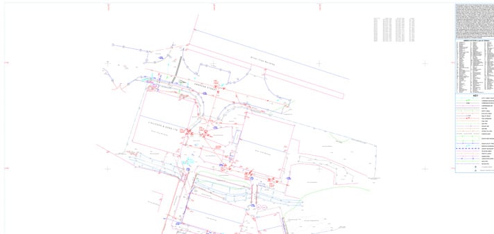
Recent Projects
Specialising in the management of risk associated with all of engineering tasks throughout a project.
A reliable and efficient company
”We've been working with Intersect for several years and have always found them to be reliable, efficient and good value for money. I can honestly recommend them."

Excellent customer care
”The whole process was very smooth from start to finish, with excellent communication and customer care. We'll definitely be working with Intersect in the future."
Efficient and knowledgeable
”The in-depth knowledge which Intersect Surveys have in their field is second to none. They're efficient, helpful and in my opinion, excellent value. "
What Our
Clients Say
Who We
Work With

News & Blogs

Monitoring in Real-Time: How Live Alerts Reduce Structural and Environmental Risk
On a busy construction site, things can change in an instant. A small shift in a retaining wall, a spike in dust...

Structural vs. Environmental Monitoring: What's the Difference and When Do You Need Both?
Why Environmental Monitoring Can’t Be Ignored As urban development grows more complex, project teams face rising...

Why Environmental Monitoring Is No Longer Optional for Construction Sites
Why Environmental Monitoring Can’t Be Ignored Construction sites today operate in a climate of increased...